
Exploring Collinear Bus Routes in Atlanta as Artifacts of Segregation
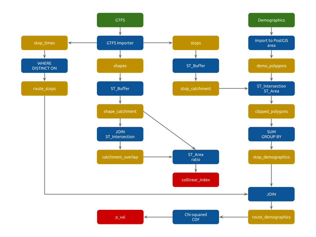
Regions with uncoordinated transit agencies often have multiple bus routes running parallel, creating a confusing user experience and costly competition. We hypothesized that such cases might persist if the collinear bus routes serve demographically distinct populations. I developed an algorithm (Python + PostGIS) to automatically identify collinear bus routes from standardized transit data (GTFS) and statistically compare the demographic character of the populations served by the stops of each route. My colleague, Dylan Halpern, visualized the results in a stylish, interactive web map (Leaflet).
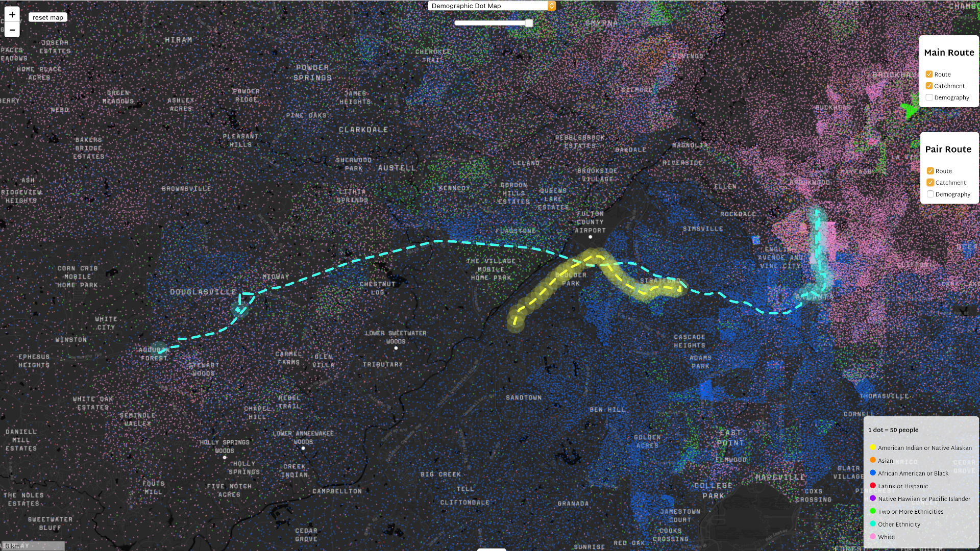
Using Atlanta as a case study, we found several examples that support our hypothesis. In the screenshot below, the blue route connects the predominately white Stewart Woods suburb to downtown without stopping once in the predominantly black neighborhoods served by the parallel yellow route. The donut plots show the demographic profile of the market areas, calculated by clipping 2010 census data with 500 meter buffers around the bus stops of each route.

Researching the history of the Atlanta region, Rachel discovered a sequence of political decisions that led to these cases of segregative collinearity. Typically, more affluent and white suburbs turned down proposals to extend the downtown transit system across county borders. Decades later, those peripheral counties introduced their own transit services to downtown. With the stated intention of avoiding competition, those new routes would not stop in the inner suburbs. The result is an inefficient system that segregates users by race and economic class.
Explore the tool here!
Dylan Halpern and Rachel Luo presented DoubleUp at the launch of MIT’s Schwarzman College of Computing.